

Project Mer: unprecedented coastal mapping begins to "restore" Italy's seas
With the award of the tender to map the habitats of the entire Italian coast, the PNRR-funded project to protect Italy's coastal heritage takes off.


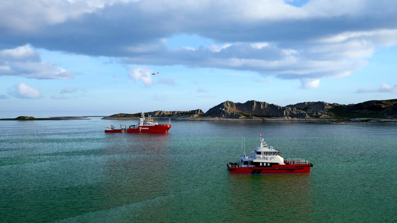
In a bold initiative under the National Recovery and Resilience Plan, the Marine Ecosystem Restoration (MER) project is poised to revolutionize the conservation and restoration of marine ecosystems along the entire Italian coastline. ISPRA (Istituto Superiore per la Protezione e la Ricerca Ambientale) recently awarded the tender to a consortium led by Fugro, known for its cutting-edge technology.
Advanced Technology for Detailed Mapping
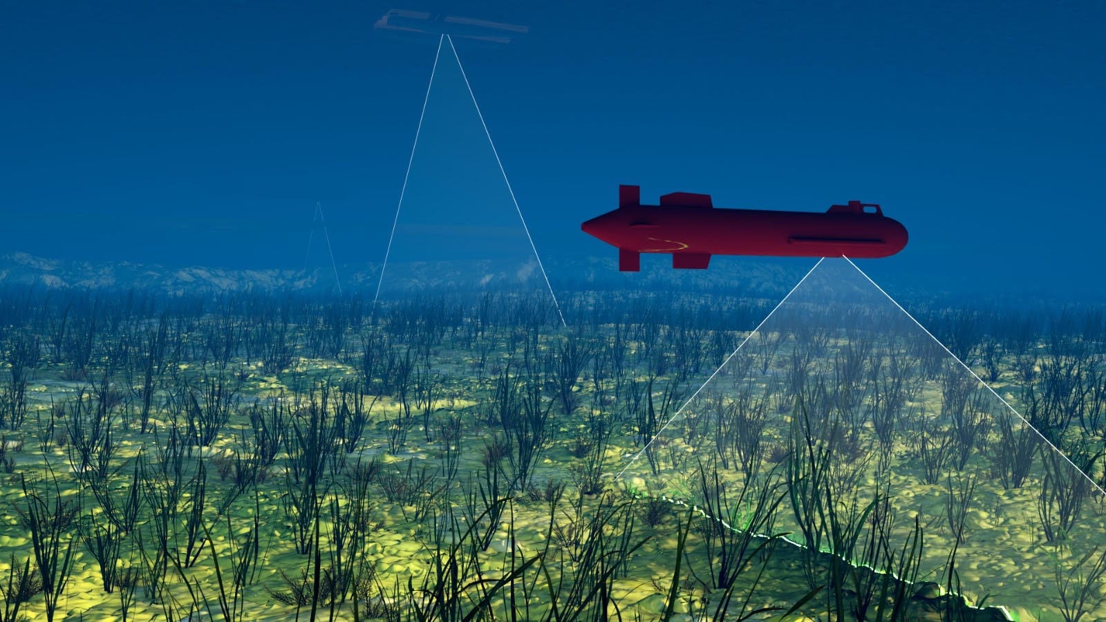
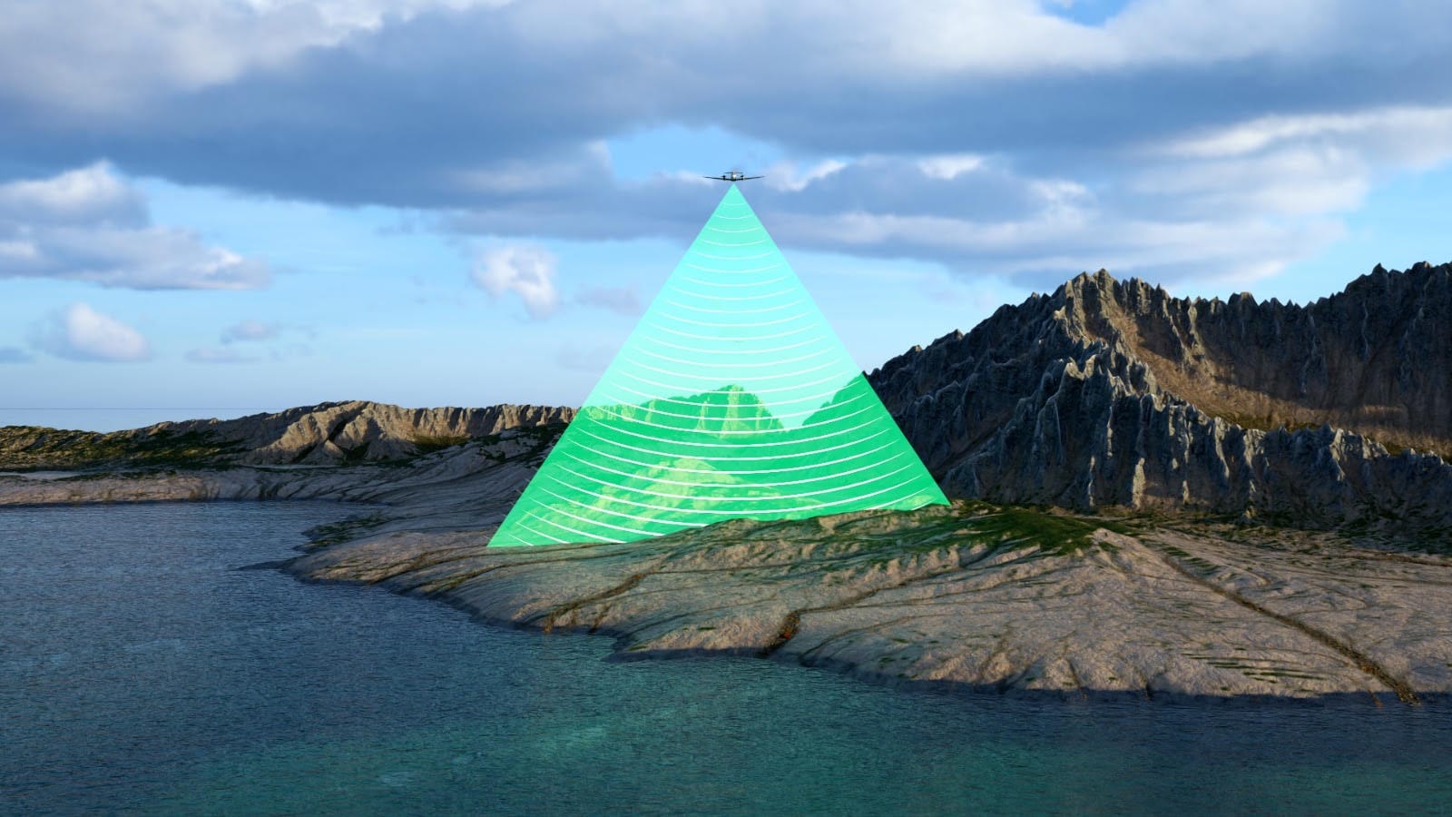
The project, divided into the sub-regions of the Western Mediterranean Sea, Ionian Sea, Central Mediterranean Sea, and Adriatic Sea, will employ a range of advanced sensing technologies. These include LiDAR and airborne optical sensors, airborne gravimetry (a technique that uses sensors that measure gravity, which is useful in getting to greater detail), and multispectral satellite sensors will be used to map Posidonia oceanica and Cymodocea nodosa seagrass beds. This revolutionary approach will cover an area of 10,200 km2, and multibeam technology and an autonomous submarine vehicle will be used for direct observation of 4,000 kilometers of coastline. Comprehensive mapping of the coastal strip up to 800 meters from the coastline inland with LiDAR, optical and gravimetric sensors is also planned.
The Creation of the Digital Atlas of the Seas.
ISPRA President Stefano Laporta expresses enthusiasm for the start of the LiDAR survey procedures, stressing that with the MER project it will be possible to create the Digital Atlas of the Seas, contributing to the preservation of marine biodiversity.
"The project of mapping our coasts takes the first step, thanks to LiDAR technology we will create the Digital Atlas of our seas ," says ISPRA President Stefano Laporta. "With the MER plan, Ispra has launched an ambitious package of interventions for the protection and enhancement of the Mediterranean ecosystem. These include activities with the LiDAR sensor, one of the pillars on which our extraordinary marine restoration program is based. Thanks to the surveys conducted along the entire coastline for a total of 7,500 km, unprecedented in Italy in terms of extent but also detail, we will have extremely valuable information both in the sphere of discovery of new species and habitats and in the sphere of conformation of the seabed for geothermal."
Maria Siclari, director general of ISPRA, adds that mapping deep-sea habitats will provide detailed information on bathymetry and coastal morphology, improving the ability to predict phenomena such as coastal erosion.
"The LiDAR sensor will allow us to create the treasure chest in which we will store marine biodiversity," adds Maria Siclari, director general of ISPRA."The mapping of deep-sea habitats will also survey more than 70 underwater mounds, from 500 to 2,000 meters deep, investigating areas that have never been monitored and are almost completely unknown. Through this project, we will be able to identify coastal marine habitats with high resolution and provide detailed information on bathymetry and coastal morphology, enabling reliable predictions of coastal erosion phenomena and coastal vulnerability to extreme events such as storm surges and coastal flooding."
Concrete Conservation Projects
The MER plan (funded under the NRP with a 400 million euro fund for the period 2022-2026) is not just on paper, but is being translated into concrete projects. Ispra has approved 18 projects to set up 91 mooring camps in marine protected areas, National Parks and Special Areas of Conservation. These camps mitigate damages related to anchoring, preserving marine habitats. In addition, the plan addresses the problem of "Ghost Nets " and all fishing gear abandoned at sea, with a procedure for their removal and proper disposal. ISPRA data show that 86.5 percent of waste at sea is related to fishing activities and 94 percent of these are abandoned nets.
Repopulation and Active Monitoring
The project also includes restocking in Friuli Venezia Giulia, Veneto, Emilia Romagna, Marche and Abruzzo, of a native Adriatic oyster species (Ostrea edulis). By starting the rearing of one million larvae, the aim is to rebuild European flat oyster beds - currently reduced by 85 percent - valuable habitats for marine biodiversity. Also in the pipeline is the construction of a new oceanographic research vessel, equipped with state-of-the-art technology for deep-sea monitoring.
Sustainability Information Platform
Finally, an information platform is being created to allow full use of all the information collected. This tool will be essential for assessing the sustainability of marine activities and planning the mitigation measures needed to address the challenges of climate change in the Mediterranean Sea.
With the MER plan, Italy is making a tangible commitment to marine conservation by harnessing cutting-edge technologies to promote the recovery of marine and coastal ecosystems.


